The best 7 days Kilimanjaro climbing Lemosho route Overview
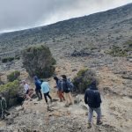
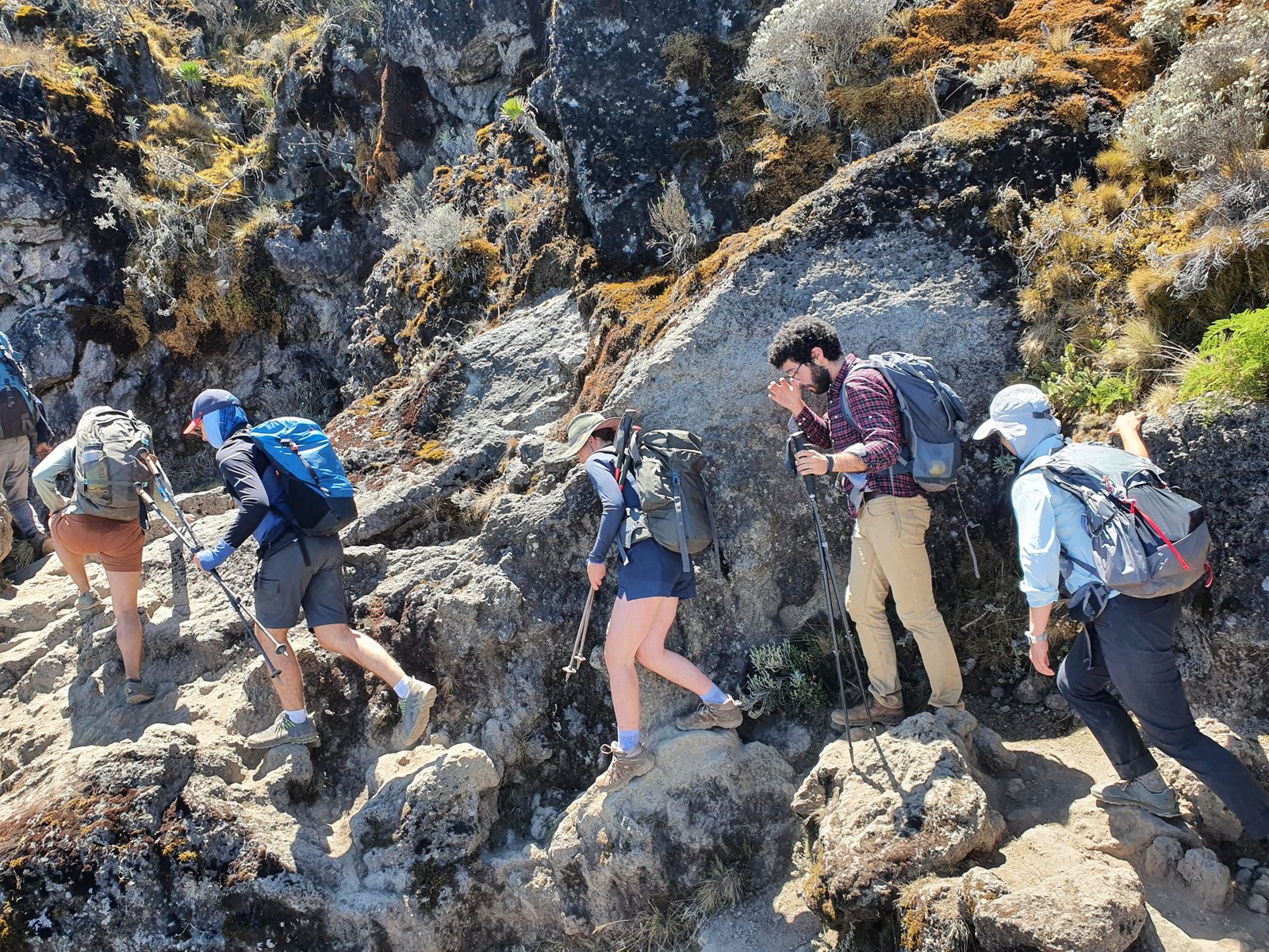
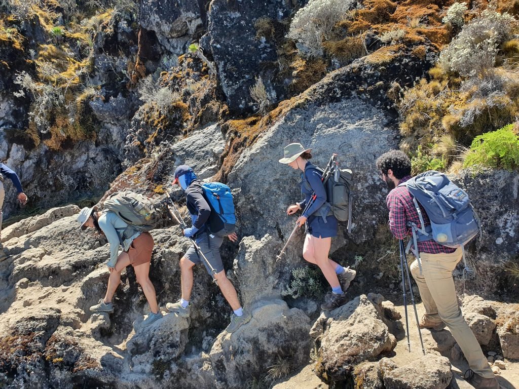
This best 7 days Kilimanjaro climbing Lemosho route is considered one of the most scenic and diverse routes to climb Mount Kilimanjaro in Tanzania. The route starts from the western side of the mountain and follows a relatively gradual ascent, allowing for better acclimatization and higher success rates. This Lemosho route passes through a variety of landscapes, including lush rainforests, heathlands, and alpine deserts, before reaching the summit at Uhuru Peak, which stands at 5,895 meters (19,341 feet). Along the way, climbers will encounter a wide variety of flora and fauna, including unique wildlife such as colobus monkeys and giant ground squirrels. This Kilimanjaro climbing Lemosho route is considered a challenging but rewarding trek, offering breathtaking views of the mountain and its surroundings. It is often recommended for experienced climbers who want to take their time to acclimatize properly and enjoy the unique beauty of the mountain.
Departure / Return Location
Kilimanjaro International Airport
Departure Time
Please arrive at least 2 hours before flight.
Included
- Park fees
- Camp fees
- Rescue fees
- Professional mountain guides, cooks and porters
- 3 meals daily while on the mountain
- Transportation to & from the mountain gate
- Portable toilet
- Accommodation in Arusha or Moshi
- Fair and ethical treatment of porters
- Crisis management and safety procedures
- Emergency oxygen
- Large portions of fresh, healthy nutritious food
- Clean, purified drinking water
- Medical Kit and Oximeter
Not Included
- Both National and International flights
- Medical insurance
- Tips to mountain crew
- Items of a personal nature
- Laundry Services
The best 7 days Kilimanjaro climbing lemosho route price/cost 2024
The cost of climbing Kilimanjaro’s Lemosho Route can vary depending on factors such as the tour type, level of service, and season. On average, a 7 days climb can cost between $1,600 and $3,500 USD per person it depends on the group size, Accommodation level before and after hiking, services during Kilimanjaro hiking and can be paid in term of Dollar USD($), Tanzania shillings(Tsh) Euro and Pound.
The best 7 days kilimanjaro climbing tour itinerary
A full detailed 7 days Lemosho route on Kilimanjaro climb itinerary: Day 1:Londorossi Gate to Forest Camp; Day 2: Forest Camp to Shira Camp; Day 3: Shira Camp 1 to Shira 2 to Moir Camp; Day 4: Moir Hut to Lava Tower to Barranco Camp; Day 5: Barranco Camp to Karanga Camp to Barafu Camp; Day 6: Barafu Camp to Summit to Mweka Camp; Day 7: Mweka Camp to Moshi.
Day 01: Londorossi Gate to Forest Camp
Elevation (ft): 7,800 ft to 9,500 ft6 km distanceHiking Time: 3-4 hoursHabitat: Rain ForestWe depart Arusha/Moshi for Londorossi Gate, which takes about 4 hours, where you will complete entry formalities. Then drive to the Lemosho trailhead (it takes another hour to reach the trailhead). Upon arrival at the trailhead, we eat lunch and then continue through undisturbed forest, which winds to the first camp site
Day 02:Forest Camp to Shira Camp
Elevation (ft): 9,500 ft to 11,500 ft 8 km distance Hiking Time: 5-6 hours Habitat: Moorland We continue on the trail leading out of the forest and into a savannah of tall grasses, heather, and volcanic rock draped with lichen beards. As we ascend through the lush rolling hills and cross several streams, we reach the Shira Ridge before dropping gently down to Shira 1 camp. The view of Kibo from across the plateau is amazing.
Day 03:Shira Camp 1 to Shira 2 to Moir Camp
Elevation (ft): 11,500 ft to 13,800 ft Distance: 14 kilometers Hiking Time: 5-7 hours Habitat: Moorland We explore the Shira plateau for a full day. It is a gentle walk east toward Kibo’s glaciered peak, across the plateau, which leads to Shira 2 camp on moorland meadows by a stream. Then we continue to Moir Hut, a little-used site at the base of Lent Hills. A variety of walks are available on Lent Hills, making this an excellent acclimatization opportunity. Shira is one of the highest plateaus on Earth.
Day 04:Moir Hut to Lava Tower to Barranco Camp
Elevation (ft): 13,800 ft to 13,000 ft 7 km distance Hiking Time: 4-6 hours Habitat: Semi-desert From the Shira Plateau, we continue to the east up a ridge, passing the junction towards the peak of Kibo. As we continue, our direction changes to the south-east towards the Lava Tower, called the “Shark’s Tooth.” Shortly after the tower, we come to the second junction, which brings us up to the Arrow Glacier at an altitude of 16,000 ft. We now continue down to the Barranco Hut at an altitude of 13,000 ft. Here we rest, enjoy dinner, and stay overnight. Although you end the day at the same elevation as when you started, this day is very important for acclimatization and will help your body prepare for summit day.
Day 05:Barranco Camp to Karanga Camp to Barafu Camp
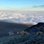
Elevation (ft): 13,000ft to 15,000ft Distance: 9 km; hiking time: 8–10 hours Habitat: Alpine Desert After breakfast, we leave Barranco and continue on a steep ridge, passing the Barranco Wall, to the Karanga Valley campsite. Then, we leave Karanga and hit the junction, which connects with the Mweka Trail. We continue up to the Barafu Hut. At this point, you have completed the South Circuit, which offers views of the summit from many different angles. Here we make camp, rest, enjoy dinner, and prepare for the summit day. The two peaks of Mawenzi and Kibo are to be seen from this position.
Day 06: Barafu Camp to Summit to Mweka Camp
Elevation (ft): 15,300 ft to 19,345 ft (and down to 10,000 ft) Distance: 5 km ascent; 12 km descent. Hiking Time: 7-8 hours up; 4-6 hours down. Habitat: Arctic Very early in the morning (midnight to 2 a.m.), we continue our way to the summit between the Rebmann and Ratzel glaciers. You head in a northwesterly direction and ascend through heavy scree towards Stella Point on the crater rim. This is the most mentally and physically challenging portion of the trek. At Stella Point (18,600 ft), you will stop for a short rest and be rewarded with the most magnificent sunrise you are ever likely to see (weather permitting). From Stella Point, you may encounter snow all the way on your 1-hour ascent to the summit. At Uhuru Peak, you have reached the highest point on Mount Kilimanjaro and the continent of Africa. Faster hikers will see the sunrise from the summit. From the summit, we now make our descent, continuing straight down to the Mweka Hut camp site, stopping at Barafu for lunch. You will want gaiters and trekking poles for the loose gravel going down. Mweka Camp is situated in the upper forest, and mist or rain can be expected in the late afternoon. Later in the evening, we enjoy our last dinner on the mountain and a well-deserved sleep.
Elevation (ft): 10,000 ft to 5,400 ft Distance: 10 kilometers Hiking Time: 3-4 hours Habitat: Rain Forest After breakfast, we continue the descent down to the Mweka Park Gate to receive your summit certificates. At lower elevations, it can be wet and muddy. Gaiters and trekking poles will help. Shorts and t-shirts will probably be plenty to wear (keep rain gear and warmer clothing handy). From the gate, you continue another hour to Mweka Village. A vehicle will meet you at Mweka village to drive you back to your hotel in Arusha or Moshi.
Book your spot now via Email